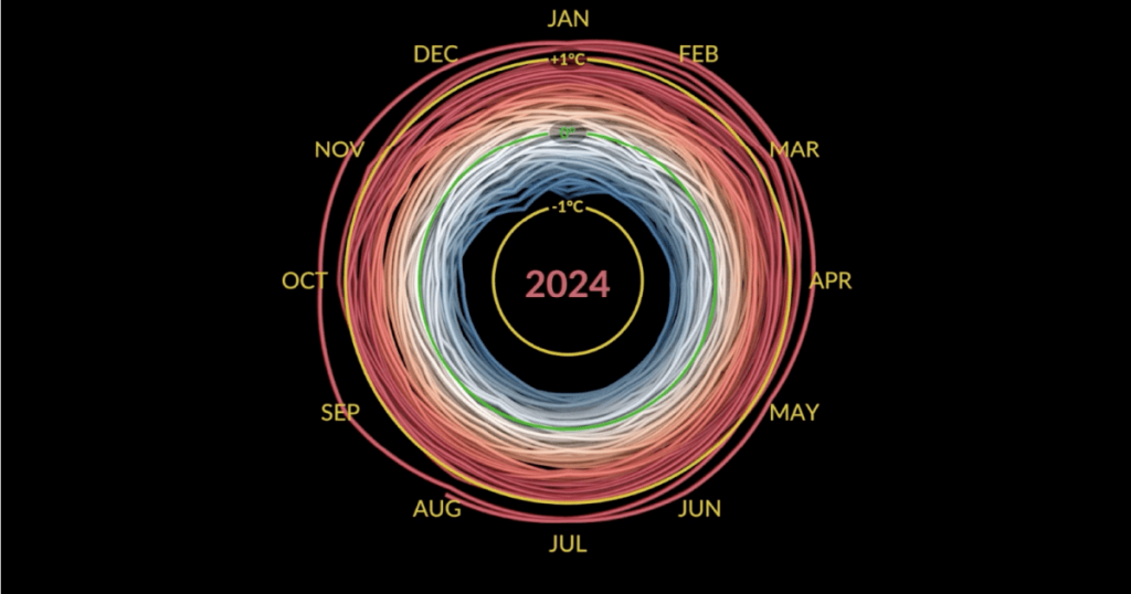
The year 2024 is on track to be the hottest on record, surpassing the previous record set in 2023, according to the European Union’s Copernicus Climate Change Service (C3S). This year, global temperatures are projected to exceed 1.5C (2.7F) above pre-industrial levels, marking the upper limit set by the Paris Agreement. The agreement aimed to reduce global greenhouse gas emissions to limit the global average surface temperature increase to 1.5C above pre-industrial levels and keep it below 2C. Samantha Burgess, deputy director of C3S, emphasized the urgent need for ambitious climate action in light of these findings.
The rising temperatures in 2024 have already triggered extreme weather events across the globe, including deadly floods in Nigeria and Europe, devastating wildfires in South America, early heatwaves, and catastrophic hurricanes in the United States. These events serve as a stark reminder of the impacts of climate change and the urgency for countries to address the issue through collective action.
In January 2024, the world experienced the warmest January on record, with an average surface air temperature of 13.14˚C, surpassing the previous record set in 2020 by 0.12˚C. This marked the eighth consecutive month that was the warmest on record, starting in June 2023 and ending in June 2024. February saw the Northern Hemisphere experience its warmest winter on record, with unprecedented ocean temperatures reaching 21.09C (69.8F), surpassing the previous record set in August 2023.
The increase in sea temperatures is attributed in part to the El Nino climate pattern, which causes unusually warm waters in the eastern Pacific. However, climate scientist Richard Allan noted that sea surface temperatures are at record levels in regions far from El Nino’s center, such as the tropical Atlantic and Indian Ocean. This highlights the significant impact of rising greenhouse gas emissions on global warming and the need for immediate action to address the issue.
In June, as sea temperatures continue to rise, evaporation speeds up, transferring more heat from the oceans to the air. This leads to stronger winds, heavier rainfall, and greater flooding when storms move over warm oceans and reach land. Hurricane Beryl, the season’s first hurricane in the Atlantic, became the earliest Category 5 hurricane on record, with winds exceeding 157mph (252km/h). Beryl formed on June 28 and rapidly intensified into a major hurricane, causing significant damage and highlighting the intensifying impacts of climate change on extreme weather events.


