The central US is facing severe weather threats towards the end of the weekend, with a potential derecho that may bring dangerous winds and large hail across Kansas and Oklahoma. A recent deadly derecho has already caused serious damage and casualties in Texas and Louisiana, emphasizing the destructive potential of these storms. Severe thunderstorm watches have been issued across multiple states in the central US, with some areas designated as a “Particularly Dangerous Situation” due to the severity of the forecasted storms.
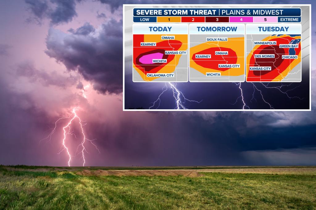
NOAA’s Storm Prediction Center has increased the severe weather threat for central Kansas, with the potential of destructive wind gusts and large hail. The threat is expected to expand to the east on Monday and Tuesday, putting millions of people at risk in the Plains and Midwest. There are concerns about the formation of a derecho, which could bring wind gusts exceeding 100 mph, large hail, and potential tornadoes. A Level 4 out of 5 risk has been placed on nearly 570,000 people in Kansas, with further areas under a Level 3 risk, including Dodge City, Wichita, Woodward, and other regions in Kansas and Oklahoma.
The central US faces a serious severe weather threat that extends to multiple states from South Dakota to Texas. This includes the potential for supercell thunderstorms and bow echo formation with damaging wind gusts as strong as a Category 2 hurricane. The risk of life-threatening conditions such as lightning, tornadoes, hail, and wind gusts is particularly high, affecting areas like Topeka, Hays, and the Houston metro area. There are concerns about swaths of wind gusts between 80-100 mph, with localized areas facing gusts exceeding 100 mph.
As the severe weather threat continues to escalate, forecasters are now keeping an eye on Monday and Tuesday for potentially dangerous conditions. Millions of people across various states in the Plains and Midwest have been placed at risk, including cities like Omaha, Des Moines, and Chicago. The thunderstorms developing in these regions have the potential to produce damaging wind gusts, hail, and tornados, heightening concerns for residents and communities. A Level 2 out of 5 risk has been issued for these areas, with thunderstorms expected to intensify over the next couple of days.
Tuesday brings a Level 3 out of 5 risk for severe weather, covering more than 9.5 million people in the Plains to the Midwest. With a significant threat of damaging wind gusts, hail, and tornadoes, residents in these areas need to remain vigilant and prepared. A broader Level 2 out of 5 risk encompasses over 31.5 million people across multiple states like Oklahoma, Michigan, and Wisconsin. Cities like St. Louis, Minneapolis, and Green Bay are within this risk area, highlighting the widespread impact of the severe weather conditions expected to persist through the upcoming days.


