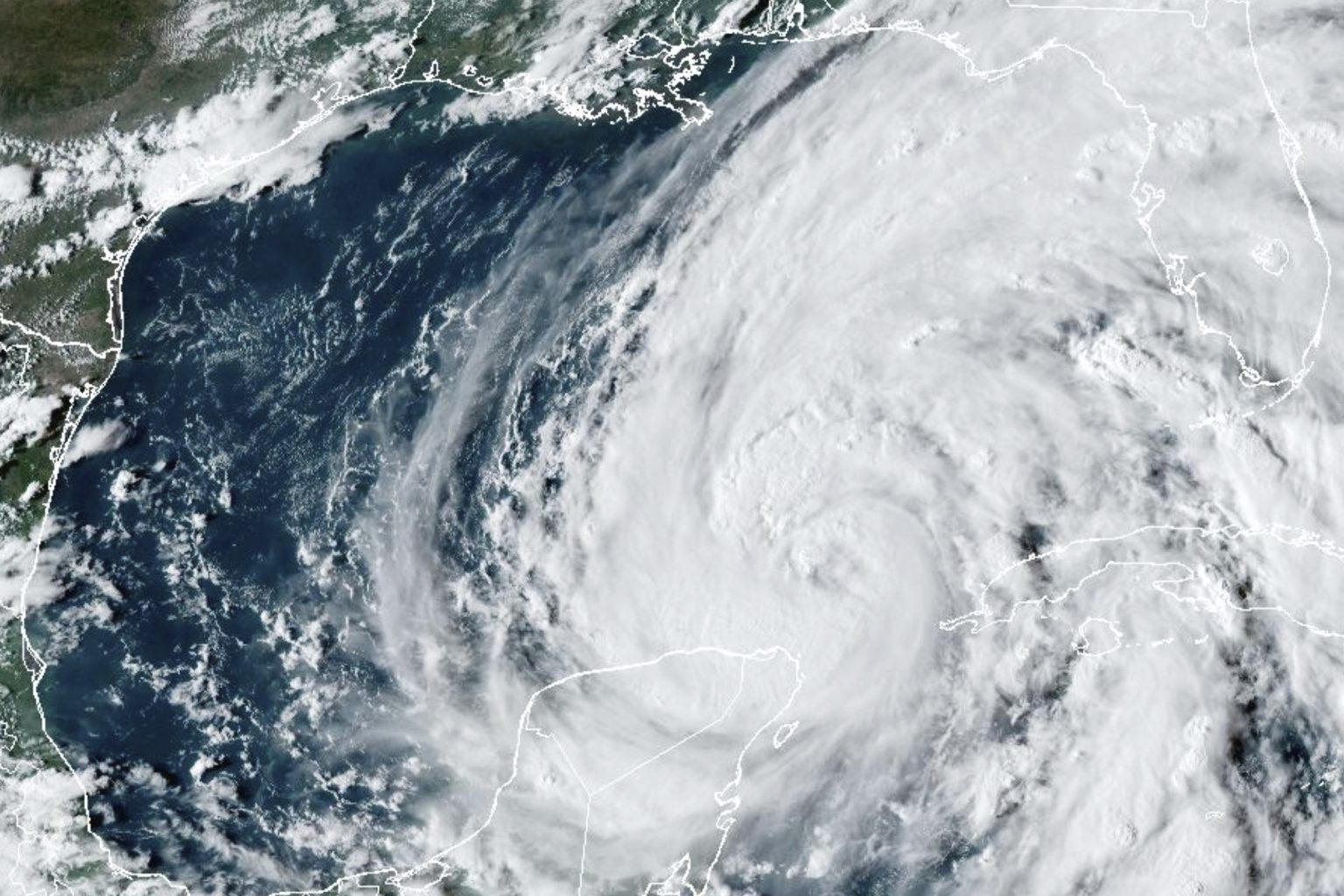
As Hurricane Helene approaches Florida’s Big Bend coast, the National Weather Service has issued a dire warning of an “unsurvivable” storm surge. The rapidly intensifying storm is forecast to make landfall as a Category 3 or stronger hurricane on Thursday evening, prompting evacuations in several Florida counties. The NWS predicts a storm surge of up to 20 feet in areas surrounding Apalachee Bay, describing the scenario as a “nightmare surge scenario.”
Currently located about 500 miles south-southwest of St. Marks, Florida, Hurricane Helene has wind speeds of 85 mph and is moving north at 9 mph. The storm is expected to gain strength as it approaches land, bringing high winds, torrential rain, and the potential for widespread power outages and structural damage across the Big Bend and southern Georgia. The NWS warns of the possibility of complete roof and wall failures in some areas, as well as significant rainfall leading to flash flooding.
In addition to the life-threatening storm surge, Helene’s impacts could reach far inland, with potential effects in Alabama, Georgia, Tennessee, and Kentucky by the weekend. Mandatory evacuations have been issued for several counties along the Florida Gulf Coast, and the National Hurricane Center is urging residents to heed these orders. The NWS emphasized the danger of storm surge as the leading killer associated with tropical storms and hurricanes, warning that even areas not directly hit by the center of the storm could still face life-threatening flooding.
The NWS is forecasting a storm surge of up to 20 feet from Hurricane Helene for the Big Bend of Florida, a scenario that could inundate coastal communities and wash away buildings. Residents in evacuation zones are being urged to leave immediately to ensure their safety. To illustrate the danger, a video of a massive storm surge from 2022’s Hurricane Ian was reposted on social media, showing the destructive potential of such a surge. As Helene approaches landfall, the NWS is monitoring the storm’s progress and is expected to provide updates on its forecast and impact.
The destructive power of Hurricane Helene is not limited to the storm surge, as the high winds and torrential rain could also cause widespread damage and dangerous conditions in the affected areas. The NWS warns of the potential for complete roof and wall failures, destruction of mobile homes, and widespread power outages as a result of the storm. While tornadoes are not the primary threat, there is a possibility of a few developing along and to the east of Helene’s path, adding to the dangerous conditions expected from the storm.
As the situation continues to unfold, residents in Alabama, Georgia, Tennessee, and Kentucky are also being urged to remain on high alert for the impacts of Hurricane Helene. The storm is expected to push inland after landfall, spreading its effects across a wider geographical area and potentially causing significant damage far from the coast. The NWS will continue to provide updates on the storm’s progress and its potential impact, with the next update expected at 6 a.m. central time on Thursday as communities prepare for Hurricane Helene’s arrival.


