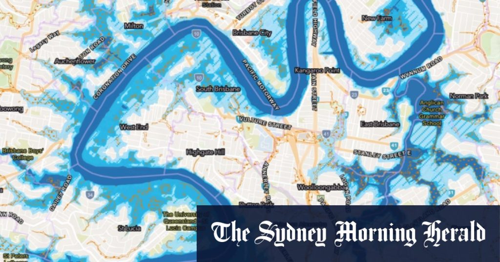
Hydrological studies in Brisbane have prompted the City Council to make changes to flood overlay mapping for 8000 properties. These updated maps will now be integrated into the City Plan and will play a role in shaping future development decisions, as well as aiding in disaster preparedness. The council views these studies as routine and the results as reflective of changes in catchment conditions and improved flood modelling practices. The Flood Awareness Map provided by the council highlights suburbs that are at risk during flood events, offering valuable information for residents.
The changes to the flood overlay mapping will impact over 8000 properties situated in various catchment areas such as Kedron Brook, Brighton Creek, Toowong Creek, Sandy Creek, and Witton Creek. Although specific details regarding affected suburbs and streets have not been disclosed by the council yet, it is known that nearly 1000 properties will be completely removed from the flood overlay maps. Additionally, other properties will be reclassified to accurately represent an increased or decreased risk of flooding from nearby creeks. By staying up to date with the latest information, the council aims to provide residents with comprehensive flood resources to assist them in understanding and preparing for potential flooding risks.
Councilor Tracy Davis, who chairs the environment, parks, and sustainability committee, emphasized the importance of equipping residents with accurate information to help them prepare for varying levels of flooding risk. She pointed out that no two floods are the same, and it is vital for residents to have access to the right information to make informed decisions when it comes to preparing for floods. While it is impossible to prevent severe weather events, being better prepared can mitigate the impact of such disasters. The updates to the flood overlay mapping are designed to serve this purpose by empowering residents to make informed choices regarding their flood risk.
By incorporating the findings of the hydrological studies into the City Plan, Brisbane City Council aims to better equip residents with the necessary tools and knowledge to respond to potential flood events. The updated flood overlay mapping will not only influence future development decisions but will also contribute to increasing community awareness and preparedness. With the recognition that proactive measures are essential in dealing with natural disasters, the council is committed to providing residents with the latest and most accurate information available. These updates serve as a testament to the council’s dedication to ensuring the safety and well-being of Brisbane residents in the face of potential flooding hazards.


